
I was recently tagged in a LinkedIn post about gritter tracking data from Traffic Scotland. You can see the data in question here.
It’s becoming more common for local authorities and government agencies such as Traffic Scotland and Highways England to show their gritter locations online. This has often, as in this case, been accompanied by a public poll for funny names for the gritters. It’s interesting and it’s certainly good PR, although I do now roll my eyes at the ‘funny’ names as they are as original as most of my Dad jokes.
The post reminded me that I’d spoken about this subject before, at a Highways technology seminar no less. It seems my comments at the time are still true today -tracking gritters and sharing it with the public is fun, technically easy and yet pointless and perhaps even unwise.
What’s On Offer?
There’s a very responsive map with the locations of all Traffic Scotland’s gritters and a snail trail of where they have been. It’s quite a ‘busy’ map but it becomes clearer when you home in on smaller area.
Alongside is a disclaimer.
The Trunk Road Gritter Tracker page provides live tracking of gritters on the trunk road network. It displays the current location of gritters and a trail with an age range for where gritters have previously passed along the trunk routes across Scotland. The Gritter Tracker does not provide road treatment or gritting information.
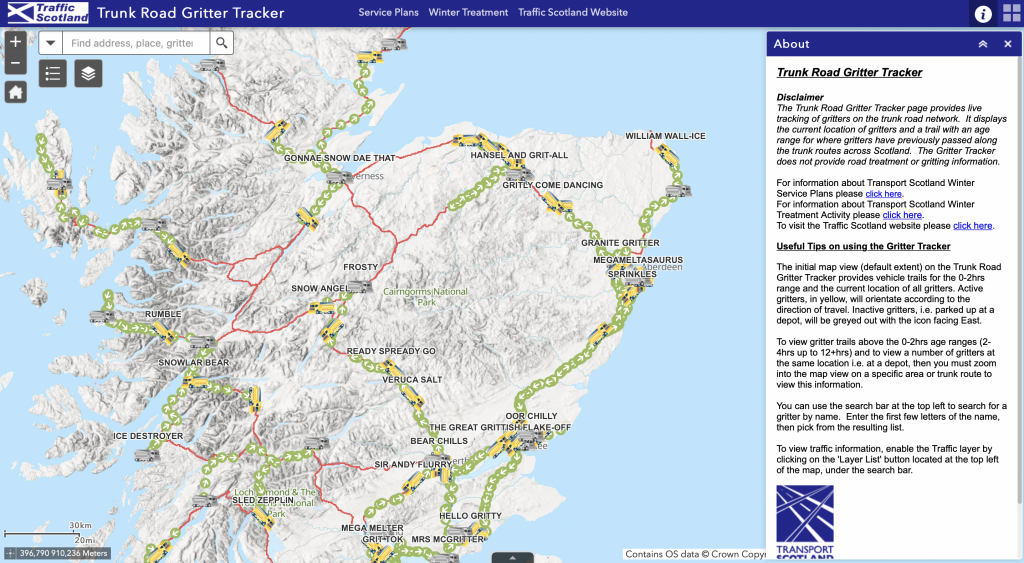
That disclaimer shows the three big limitations of this service.
- It’s limited to trunk roads and doesn’t cover the local roads most of us live and work on.
- It doesn’t show whether the gritters have treated the roads or simply driven along them
- Refresh rates are low so the trails are actually a collection of dots that don’t really join up
I don’t think this has much practical use. At a push you could deduce that a trunk road had not been gritted from lack of dots, but that’s about all.
It may seem that I’m being sniffy about all this rather than constructive. That isn’t my intention – I’d simply like to see this data turned into more useful information. I’m happy to acknowledge that there are other services already offering a little more..
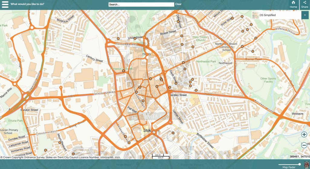
Stoke, for example, have a similar service and have embedded it in their comprehensive citizen app. This goes further than the Traffic Scotland system by also showing the standard gritting routes and also bringing grit bins, their locations and requests for refills into the picture. This does make the whole thing more relevant to a resident looking out of their window at the snow.
I still don’t think this is very useful. In fact, putting a dot on a road which says ‘a gritter was here in the last two hours’ could actually give a false impression that the road is free of ice and safe to drive on.
There is also the question of how close to ‘live’ this data should be. Those who provide the service may have very justifiable concerns about sharing live location data for their workers, even if it is not directly personally-identifiable. However, if the data is not real-time or is somehow reduced in precision to obscure it then it’s hard to see how it could be used to provide useful services.
I suggest there are three major things citizens might want to know.
- When do you grit the roads, and where?
- What’s the status of the roads I need to use for my journey?
- Is the council or highways agency providing me with a good service for my taxes?
Raw data, however nicely presented on a map, doesn’t seem to answer any of these questions.
The routes that are gritted, usually graded into 2 or 3 levels of priority, can be fairly easily presented via maps or address-based information. Simply knowing whether your street, or a street you use often, is designated for gritting is useful information that helps to set expectations.
Gritting is, by its very nature, partly guesswork based on the weather forecast so sometimes the wrong decisions are taken about whether to grit or not. Sometimes the forecast will suggest gritting roads above a certain elevation, but not lower ground. It’s not unusual for gritters to go out expecting a cold snap that never materialises, or worse, the opposite. This can lead the public to wonder why on earth gritters were / were not out!
Service managers can and do tell residents what they are doing on social media etc and I think ‘working in the open’ is a useful way to demystify the process. It can certainly help people to understand why the gritters were or were not sent out. If the gritters are sent out then it’s logical that as a motorist I would welcome that news too, via some form of alert service so I know to take extra care in my local area.
To address the second question I can envisage that third-party services, commercial or otherwise, could aggregate and interpret data to put it into a more useable context.
“Alexa, what’s my drive to work looking like?”
That requires a service to know
- what is your route to work?
- what have the road temperatures been for the past few hours?
- have all the roads on the route been treated (combining data from local, county and national services)?
- does travel information suggest there are delays?
- would public transport be a faster or safer alternative?
I don’t doubt that this kind of service could be made. We’ve already seen apps springing up to consume data about bin collections (see Leeds Bins or one if its cousins for example) and present useful functionality to the public. I have no doubt that if agencies were to publish their gritting data in a way that allowed aggregation and timely access then similar services would emerge for gritting.